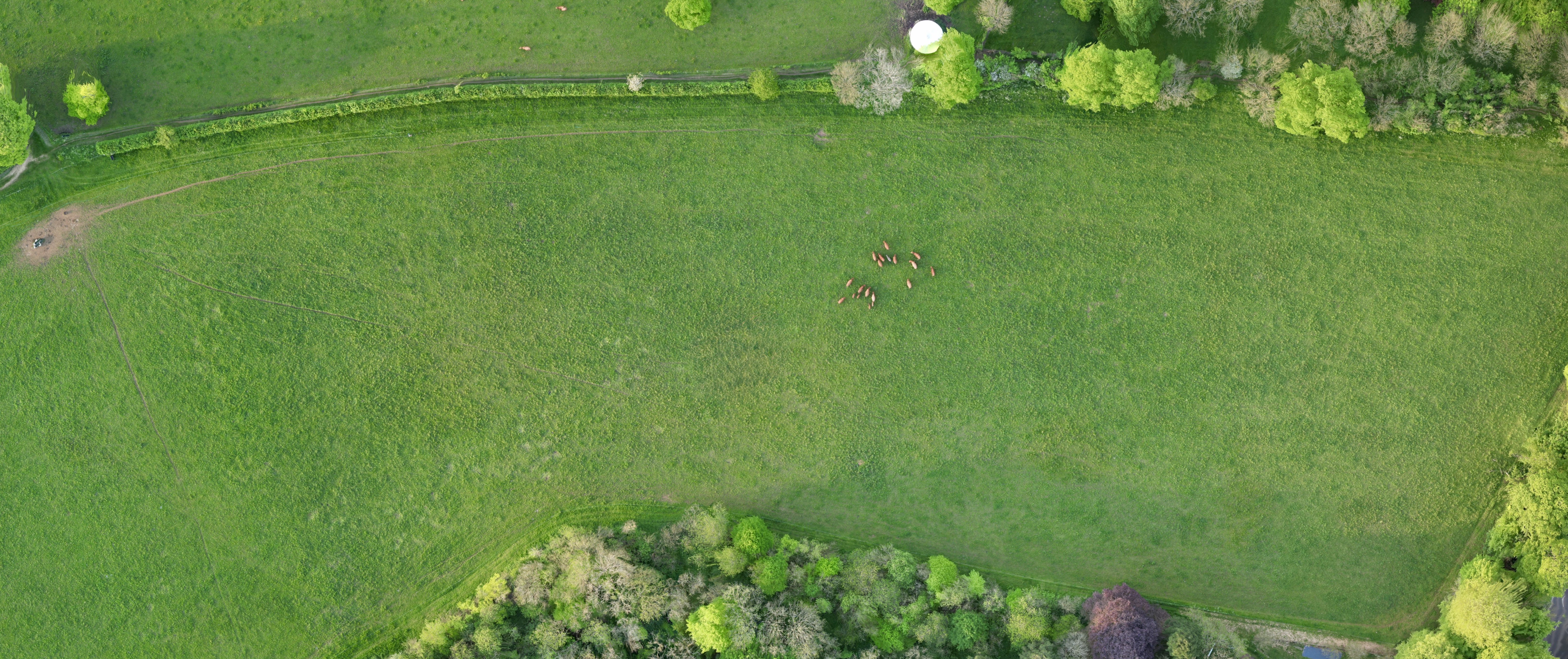
We turn aerial imagery into actionable farm insights. Our drone surveys deliver high-resolution field maps, crop health analysis to pinpoint crops under stress, and drainage assessments to identify wet areas to plan improvements. This data can then be used to claim against DEFRA grants, or to create fertiliser prescription plans.
Serving farms across Morayshire and Aberdeenshire.
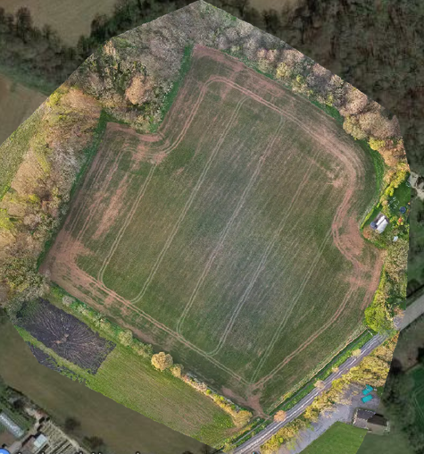
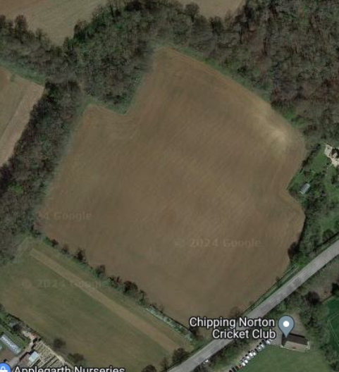
Drag to compare standard satellite imagery with a Sky High Analytics drone survey
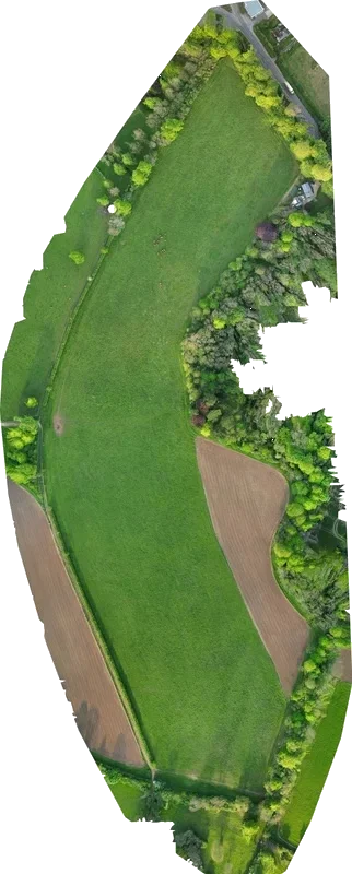
Centimetre-accurate orthophoto maps of your land. Far sharper than satellite imagery, with real-world coordinates for use in planning, boundary disputes, or grant applications.
Get in touch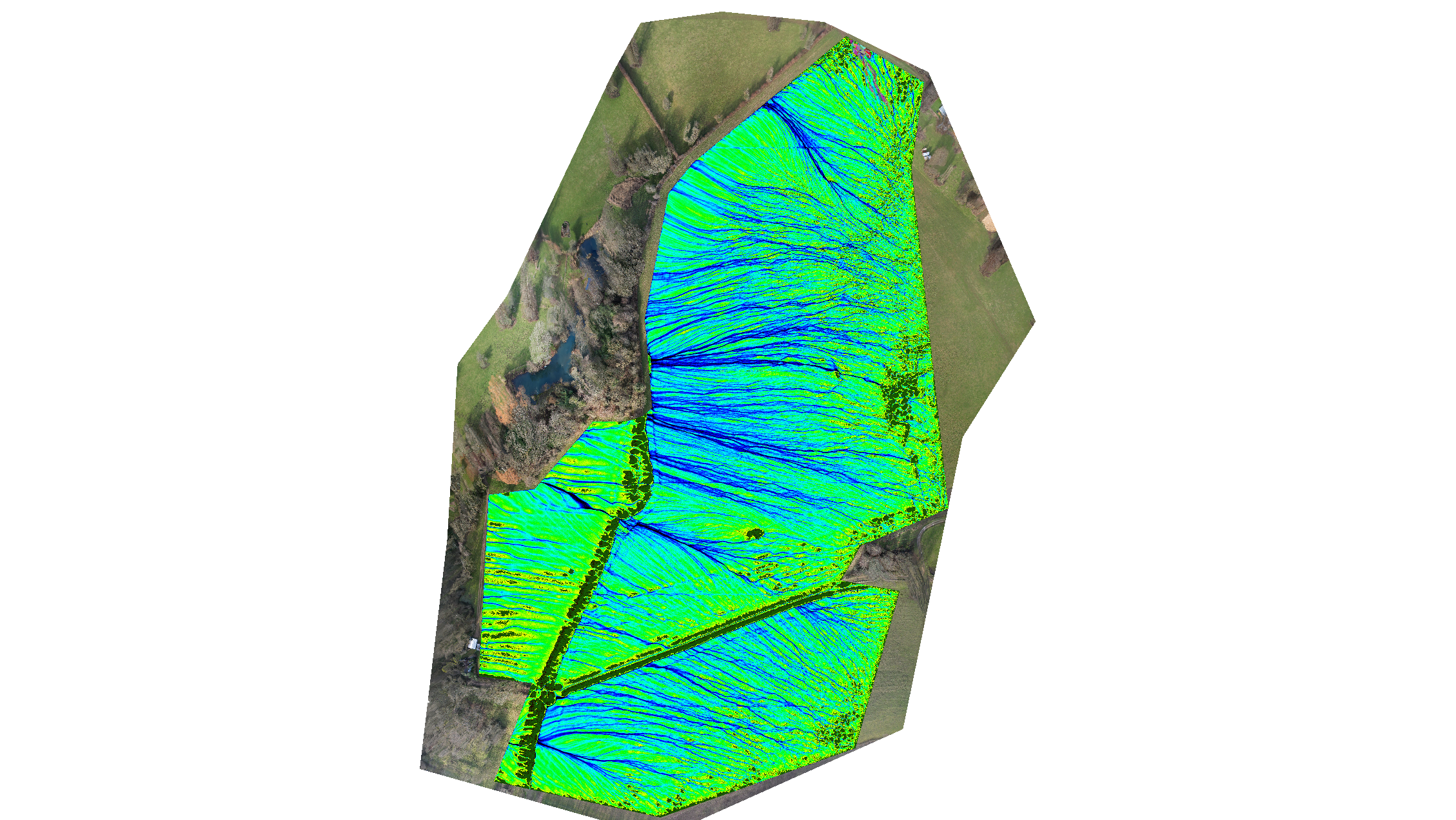
Identify wet areas, map flow paths, and plan drainage improvements. Data can support DEFRA grant applications.
Get in touch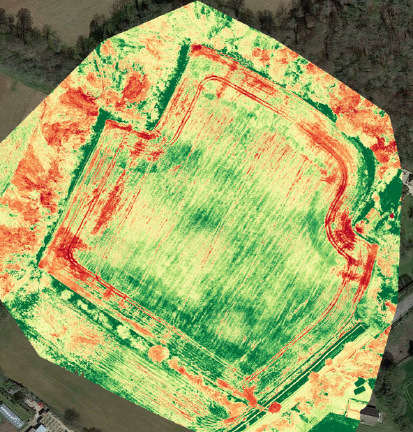
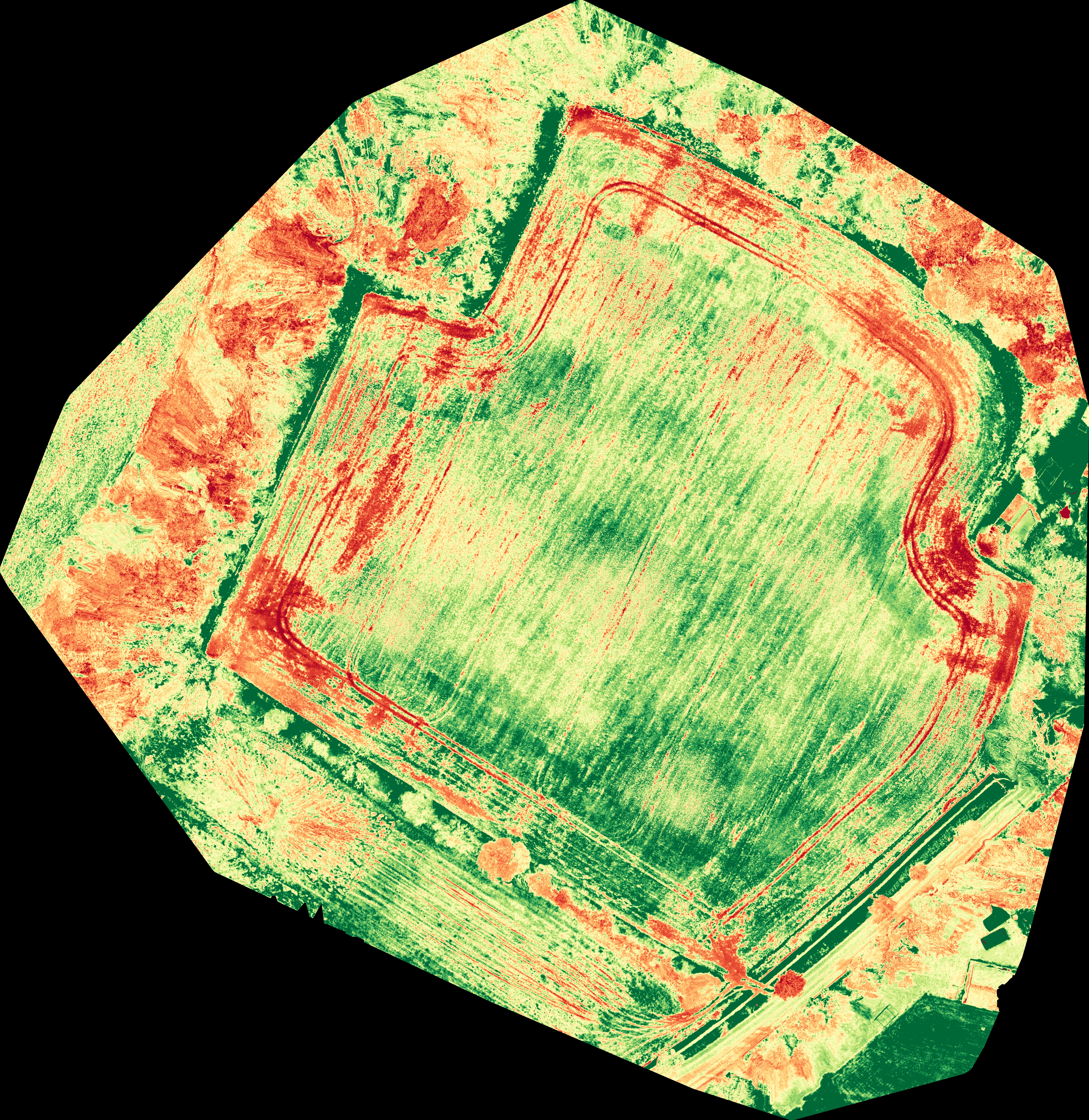
Crop stress detection using VARI analysis. Pinpoints under-performing areas so you know exactly where to investigate.
Get in touch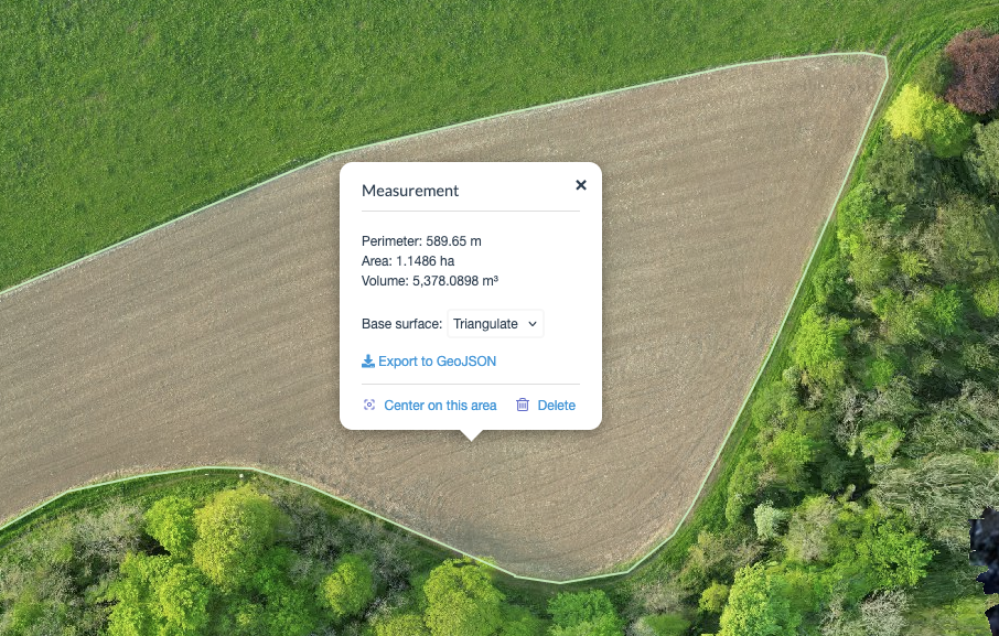
Precise field acreage and boundary mapping for subsidy claims, land transactions, or planning.
Get in touch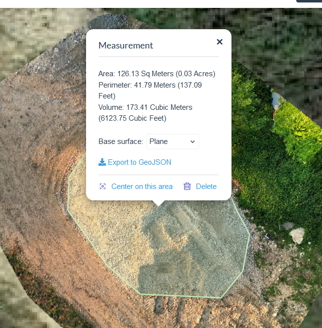
Accurate 3D volume calculations for grain, aggregate, or earthwork stockpiles.
Get in touch
We'll fly your field for free — no commitment, no upfront cost. Once we've captured the data, we'll present you with the analysis and walk you through what it shows. You only pay if you want the data. No obligation, no risk.
Get in touch